CDN1: A Cal/Val site for ESA satellites operational, in West Crete

A new research infrastructure, called CDN1, has been established for the calibration of satellite altimeters, mainly of the European Space Agency. It is set up at an elevation of 1100 m, in west Crete, Greece. The objective is to support the commissioning of Sentinel-3 Topography mission.

This Satellite Altimeter Calibration site has been operational as of 1-Sept-2015. The first satellite calibration took place on 2-Oct-2015 for the Jason-2 satellite (American/French mission).

 Its major instrument is the microwave transponder, manufactured by the Technical University of Crete, and characterized at the European Space Agency facilities in the Netherlands.

News

Launch of new website for the Laboratory
Read more
A Very Long Frequency (15kHz–50kHz) and Low Frequency (150kHz–300kHz) radio receiver has been installed at the GeoMatLab as of 28-March-2012. This…
Read more
A new EGNOS site, called "TUC3", has established within the campus of the Technical University of Crete. This site has been operational as of the…
Read more
The first Greece's only permanent Beidou/COMPASS receiver, tracking the Chinese Global Navigation Satellite System, has been installed 30-May-2012…
Read more
A Regional Outreach Workshop on "GeoMatLab's contribution to local and regional capacity building" is to be organized by the Geodesy & Geomatics…
Read more
An International Technical Workshop on "Deformation Monitoring & Satellite Altimetry Calibration" is to be organized by the Geodesy & Geomatics…
Read more
A new Google Map for the Sensor Locations, operated by the GeoMatLab, has been created. All sensor locations maintained by tha Laboratory are shown…
Read more
Please see this Cal/Val satellite facility in Gavdos island, south of Crete (English, Greek)
Read more
A. 2010, NASA Lectures: Dr. Lee-Lueng Fu from the Jet Propulsion Laboratory, NASA, Pasadena, California, USA, will give 3-day lectures at the…
Read more
Launch of SARAL/AltiKa satellite fixed. The SARAL/AltiKa launch date has been fixed by the Indian Space Research Organization and is the 12-Dec-2012.T…
Read more

Books from the Laboratory

Mertikas S. P. (editor, 1993). Global Positioning Systems in Geosciences, Proceedings of the International Workshop, Technical University of Crete, Chania, Greece, 8-10 June, 1992, Access soft, Athens, ISBN: 960-220-519-9. http://www.tandfonline.com/doi/abs/10.1080/15210609309379689

 Mertikas S.P. (1994). Failure Detection in the Measurements of the Global Positioning System, Monograph, Department of Geomatics Engineering, University of Calgary, Canada.

 MertikasS.P. (1999).  RemoteSensingandDigitalImageAnalysis, ION Publishing House, Athens, ISBN 960-405-949-1 (In Greek).https://www.mred.tuc.gr/3317.html

 Agioutantis Z. & Mertikas S.P. (2003). A Practical Guide for Technical Writing, ION Publishing House, Athens,. ISBN 960-411-394-1(In Greek). https://www.mred.tuc.gr/3331.html

Mertikas, SP. (Editor, 2010). “GravityGeoidandEarthObservation”, InternationalAssociationofGeodesy, IAGCommission 2: GravityField, Chania, Crete, Greece, 23-27 June 2008 (InternationalAssociationofGeodesySymposia), Vol. 135, DOI: 10.1007/978-3-642-10634, Springer-VerlagBerlinHeidelberg 2010. http://link.springer.com/book/10.1007%2F978-3-642-10634-7

Mertikas, S. P. (2011). “Geodesy, ground positioning and levelling”, in the Encyclopaedia of Solid Earth Geophysics, Article G., edited by Professor Harsh K. Gupta, Springer, New York. http://www.springer.com/gp/book/9789048187010

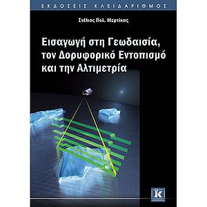
 Mertikas, S. P. (2016). “Introduction to Geodesy, Satellite Positioning and Altimetry”, Klidarithmos Publishing House, Athens, ISBN : 978-960-461-721-0 (In Greek), http://www.klidarithmos.gr/eisagogi-sth-geodesia