Geodesy Section
The Geodesy section specializes in high precision geodetic and satellite technology and applications, and is responsible for:
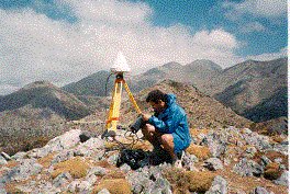
- educating and training of students with the-state-of-the-art geodetic and surveying techniques and instrumentation, such as total geodetic stations, Global Navigation Satellite Systems (GNSS) surveying, leveling, map projections, earth’s gravity field, coordinate reference frames, etc.,
- conducting research on :
- high precision satellite navigation and geodetic positioning,
- establishment of permanent GPS arrays,
- Monitoring of the tectonic and geodynamic motion of the earth’s crust, etc.,
- Satellite altimetry,
- Calibration and validation of radar satellite altimeters,
- Sea level changes,
- Data quality control,
- Development of algorithms for the detection of abrupt changes in data,
- Synthetic Apperture Radar Interferometry,
- Precise underwater positioning with GPS and acoustic transducers, etc.
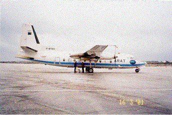
This is a photograph of the Fakker aircraft that took part in the AirGOSAT project (Airborne Gravity field surveying for Oceanography, geodesy and geophysics in Southern Aegean sea and the island of Crete). The project co-ordinator was Prof. Ilias N. Tziavos, Aristotle University of Thessaloniki.
The Laboratory of Geodesy & Geomatics Engineering is an affiliate member of the University NAVSTAR Consortium (UNAVCO, USA) as of November 1996.